


Planning a national park visit usually means switching between maps, park websites, trail notes, alerts, and saved screenshots. National Park Service brings much of that preparation into one official travel app, and after using it, I found its biggest strength is not flashy design but dependable context. It helps me understand a park before I arrive, decide what deserves my limited time, and keep useful information close while moving around. My main recommendation is simple: use it as your planning companion, not as the only tool you carry outdoors.
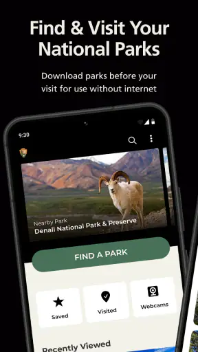
This is a free Travel & Local app from the National Park Service, aimed at everyone rather than a specialist hiking audience. Its broad coverage is the reason to install it: the app is built for all 420-plus national parks, so it can be useful for a major vacation, a spontaneous weekend stop, or a quick search for a less famous site near home. Its 4.9 average from around 33 thousand ratings and more than a million installs suggest that it has become a trusted starting point for many travelers.
What the app is like to use in real trip planning
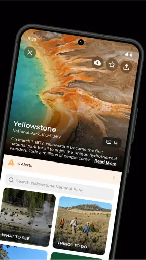
The first thing I noticed is that the app changes the way I think about a park. Instead of beginning with a single trail or landmark, I can start with the place itself and learn what kind of visit it supports. That matters because national parks are not interchangeable. A short urban historic site, a remote wilderness destination, and a coastal park require very different preparation, and a general map app rarely explains that difference clearly.
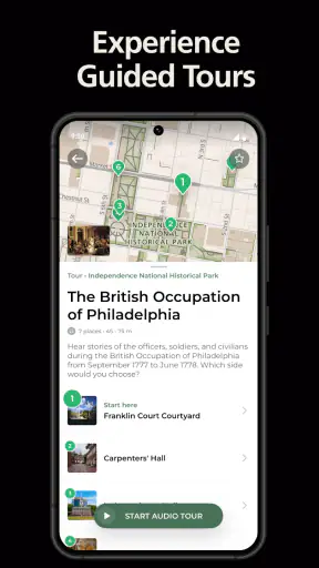
I would open it before deciding where to go, rather than waiting until I was already at the entrance. Browsing by park gives me a chance to compare destinations, look at the character of each location, and identify the information I need to verify before leaving. This is especially helpful when I am traveling with people who have different expectations. One person may want a scenic drive, another may prefer history, and someone else may only have an hour for an easy walk. The official park perspective makes those conversations more practical.
The app also works well as a reference for the details that are easy to overlook during casual research. A search engine may show popular photographs and heavily visited attractions first, but the National Park Service app keeps the focus on the park as a managed place. That encourages better questions: What is realistic in the time available? Which activity suits the group? What should I confirm before setting out? I find that more useful than simply collecting a list of famous viewpoints.
Why official context is more valuable than another generic map
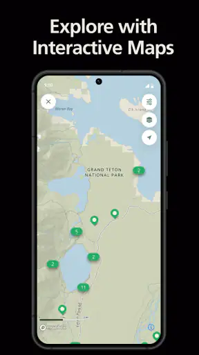
Google Maps and similar services are excellent for driving directions, estimating arrival times, and finding nearby fuel or food. They are not designed to explain the identity of a national park. A hiking app may be better for comparing user-submitted routes, elevation profiles, or recent trail comments. A dedicated navigation tool can be stronger when I need detailed route guidance in difficult terrain. National Park Service occupies a different position: it gives me an official starting point for understanding the destination.
That distinction is important. I do not expect this app to replace every other travel tool. Instead, I use it before the navigation stage. I can learn what makes the park worth visiting, then move to a mapping app for the drive and a specialized outdoor tool if my route demands more technical information. The result is less confusing than asking one app to perform every job.
There is also a trust advantage in using an app maintained by the National Park Service. Information about a protected site is more meaningful when it comes from the organization responsible for that place. I still pay attention to current notices and conditions, but the app feels like a better foundation than a random collection of travel pages, especially when I am unfamiliar with the park.
A practical workflow for a weekend visit
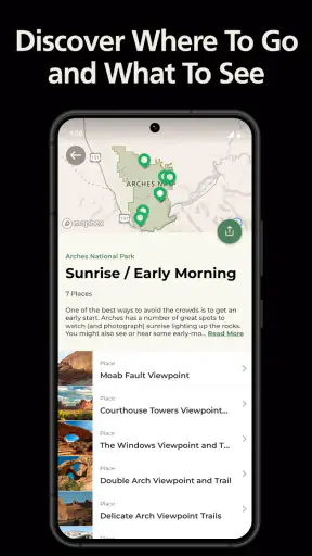
For a realistic weekend trip, I would use the app in three passes. First, I would browse the destination without trying to plan every minute. The goal is to understand its main attractions and decide what kind of experience I want. Second, I would narrow the visit to a few priorities that match the group’s energy, available time, and interests. Third, I would revisit the information shortly before departure and use it to build a simple plan with room for delays.
That last step is where many travelers make mistakes. A park can look manageable on a screen while taking much longer to cross in person. Rather than treating every listed attraction as an item to check off, I would choose one primary goal and a couple of flexible alternatives. The app is particularly useful for this because it gives the trip a sense of place instead of reducing it to a route between pins.
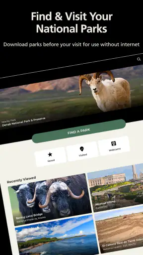
I also recommend saving or noting the information that matters before leaving reliable service. Even when an app is well designed, outdoor connectivity can be inconsistent. I would not wait until the parking area or trailhead to discover what I need. A quick preparation session at home can prevent a lot of unnecessary phone handling later.
Useful for more than big vacation parks
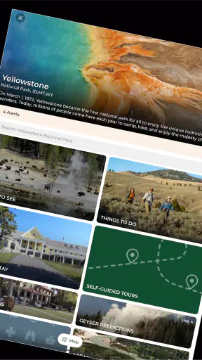
The broad park coverage makes this more valuable than an app focused only on the most famous destinations. I can use it to discover historic places, cultural sites, natural areas, and smaller parks that would otherwise be ignored because they are not part of a conventional road-trip itinerary. That makes it a good companion for residents who want nearby ideas, not just for visitors crossing the country.
It is also helpful when I am building a route with several stops. Rather than researching every location from scratch, I can use the same official source to get oriented at each park. The experience is not identical everywhere, because each site has its own character and information needs, but the common app gives the journey a consistent starting point.
Families may appreciate this approach. Children often need a clear reason to care about a place before the visit becomes interesting, while adults need to judge whether a plan is realistic. Reading about a park together can turn “we are going hiking” into a more specific conversation about scenery, stories, landmarks, or the kind of day everyone wants.
The limitations I would plan around
The app’s wide scope is also its main weakness. Covering more than 420 parks means the experience has to serve very different destinations, and a general official guide cannot provide the depth of a specialist tool for every activity. If I am planning a demanding hike, I want more than broad destination information. I may need current route conditions, detailed navigation, terrain awareness, and a backup plan. This app should not be my sole safety resource for that kind of outing.
It can also encourage a false sense of completeness. Seeing a park represented in one app may make a trip feel fully researched, but outdoor conditions change quickly. Weather, closures, road access, seasonal limitations, and local restrictions can affect the day in ways that no general planning session can eliminate. I treat the app as a strong orientation layer and confirm time-sensitive details through current official notices before traveling.
Another trade-off is that official information tends to be more measured than crowd-sourced recommendations. That is a strength when I want reliable context, but it may feel less lively to users who enjoy browsing personal trip reports, recent photographs, or informal local tips. For those travelers, a community-driven platform can add useful texture. I would combine the two rather than expecting this app to provide every kind of travel inspiration.
The interface may also feel more practical than entertaining. I see that as a reasonable choice for a public-service travel app, but people looking for a highly visual itinerary builder or a social travel feed may prefer another option. National Park Service is at its best when I already have a destination or a genuine interest in parks; it is less compelling as a general-purpose vacation scrapbook.
Who should install it, and who can skip it
I recommend it to anyone planning a visit to a national park, even if the visit is only loosely organized. First-time visitors gain the most because the app helps translate a famous name into a more realistic idea of the place. Families, road-trippers, history enthusiasts, and travelers who prefer official sources should also find it worthwhile. Since it is free and rated for Everyone, there is little barrier to keeping it available for future trips.
It is especially useful for travelers who tend to over-plan. I often start with too many possible stops, and an official overview helps me reduce the list to something achievable. It is equally useful for people who under-plan, because it prompts them to think about the destination before arriving. In both cases, the app improves the quality of the decisions rather than merely adding more information.
I would be less likely to recommend it as the main app for an experienced backcountry traveler who already has a preferred navigation system and detailed route sources. That person may still appreciate the official park background, but the app will not replace specialist preparation. Likewise, someone who only wants turn-by-turn driving directions can probably stay with a familiar maps service and open this app only when they need park-specific context.
What the current release means for compatibility
The app first appeared on February 1, 2021, and the current release is version 2.12.0. It supports Android 7.0 and newer, which makes it accessible on many older Android phones as well as recent devices. I would still install or update it before a trip rather than treating the entrance to a park as the moment to test compatibility, storage, or account settings.
Because the app is free, I can keep it installed between trips without weighing a purchase against occasional use. That matters for national parks, where visits may be months apart. I might use it heavily while planning one vacation, ignore it for a while, and then find it useful again when a nearby park becomes part of a weekend drive.
My final assessment after using it
National Park Service succeeds because it understands that visiting a park starts before the trailhead. Its best contribution is official, destination-focused guidance that helps me choose what to do, understand the place, and prepare with more intention. The breadth of coverage makes it unusually useful for travelers who visit different kinds of parks, while the free price makes it easy to recommend without hesitation.
I would not use it as a replacement for navigation, specialist hiking information, or last-minute condition checks. That is not a failure so much as a boundary worth understanding. The strongest setup is to pair it with a regular maps app and, when necessary, a dedicated outdoor navigation tool. Used that way, it gives the trip a reliable foundation without pretending to be the entire travel kit.
My verdict is positive: National Park Service is one of the most sensible first installs for anyone visiting a U.S. national park. It is calm, practical, and more useful the earlier I open it. If I wanted a social feed or technical trail navigation, I would look elsewhere. If I wanted to know where I am going and why the destination matters before I arrive, this is the app I would recommend to a friend.


